Research
Bettina Sellmeier started her research on the topic of landslides, especially rockfalls in January 2011 with her PhD project. The following excerpt covers the main aspects of research during the PhD period.
Rockfall events of the last years like the one in Tramin at January 21st or the events at the Gotthard highway emphasize the significance of infrastructure rockfall-hazard-analysis. The time of failure of rockfalls in general is often hard to predict due to non-accessible release areas and high process velocities. Most approaches of hazard assessment are based on rockfall trajectory modelling in 3D, which analyses the rockfall process from the materials detachment to the deposit at the talus slope. Since the block volume is directly linked to the energy and the run-out distance, volume assessment plays an evident role in terms of hazard assessment. Usually the block dimensions are assessed at the talus material in combination with limited information from the source area. This information content is often not sufficient for an entire process analysis with the consideration of the detachment process. For that purpose the current research covers the following aspects:
- The detachment analysis of mid-magnitude rockfall by means of a case study
- The quantitative magnitude assessment for carbonate rockfalls, taking the talus material as well as the source area into account
- The 3D rockfall modelling based on accurate field studies, using two different modelling approaches
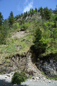
The topical aspects are addressed at the project site “Weißwand” which extends along the federal road B 305 at the region of Berchtesgaden in the Bavarian Alps, Germany. The detachment analysis of the 200 m3 critical block includes a detailed analysis of the shear parameters (Barton & Choubey 1977). The unique occasion of an accessible failure surface underneath the block afforded the opportunity to record the joint roughness coefficient (JRC) and the joint compressive strength index (JCS) in-situ at the failure surface. The recording of shear parameters was linked to a limit equilibrium analysis of the block subjected to planar failure.
The potential block magnitudes were assessed in two ways: the minimum magnitudes were determined in sample areas of 20 by 20 m each, recording rocks at the talus slope and measuring the three block axes as well as the mean obstacle height (MOH) (Dorren 2010). The maximum magnitudes were determined by mapping the source area and performing scanline analysis. The results of the block magnitudes were used for the subsequent rockfall modelling.
Potential fragmentation scenarios for the critical block were analysed using an approach of non-smooth contact dynamics under consideration of the block shape (RAMMS::Rockfall). The general rockfall hazard analysis at the project site was accomplished using an approach based on restitution coefficients (Rockyfor3D).
For all modelled rockfall scenarios we performed parameter studies in terms of magnitude variation.

